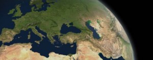
Remote Sensing Centre
Providing fast, accurate and reliable thematic spatial data for efficient management of natural and built environments.
Providing fast, accurate and reliable thematic spatial data for efficient management of natural and built environments.

New cloud-based service offers advanced solutions for storage and usage of Sentinel data or any other optical satellite data.
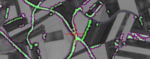
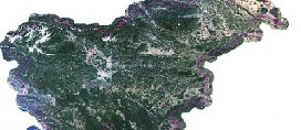
SPACE-SI has developed and implemented a complete fully automatic processing chain (called STORM). The processing chain includes all necessary processing steps from sensor-corrected optical satellite image up to web-delivered map-ready products …
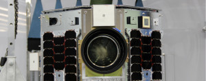
NEMO-HD is the first Slovenian microsatellite. It explores a new Earth observation concept by combining interactive real-time video streaming and multispectral imaging at 2.8 m ground resolution.
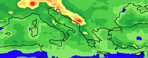
The goal of meteorology research within the center of Excellence SPACE-SI is to advance application of satellite observations in weather and climate research in Slovenia.
Recently, a project Slovenia from Space has been launched at The Centre of Excellence SPACE-SI. We have invited the Slovenian secondary schools to deal with environmentally oriented topics in local area with Space based solutions.
Space technologies are in the process of revolutionary changes, especially in the area of micro- and nanosatelites. Radical miniaturization of integrated subsystems and relatively favourable prices of…
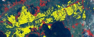
The results of developmental, scientific and technological projects will be available in various ways via online mapping, GIS applications, remote sensing, land management, observation of natural…
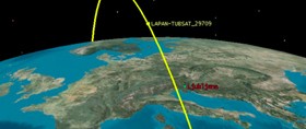
Ground stations are surface-based facilities which are designed to provide real-time communication with satellites. Space-SI has two ground stations. First, Axyom, is located in the Primorska region while the second, Stream, stands in Ljubljana. Stream is the product of slovenian design and represents the next generation of LEO tracking ground control stations for broadband and multiband communications at frequences up to 40 GHz.
Micro- and nanosatellite technologies will focus on techniques for accurate guidance of orbital platforms during interactive remote sensing and formation flying. The main developmental-exploratory breakthroughs…
Fully automatic processing of satellite data is a dream for every remote sensing professional. Within the Space-SI we have done first steps towards fulfilling this dream …
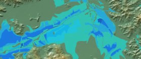
Take a look at the satellite recording of Slovenian coast and Triglav area overflight from 6th June 2010. The recording was made during a test flight in the context of an international project…
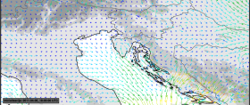
We invite you to take a look at the real time weather forecast, developed at the Department of Meteorology at Faculty of Mathematics and Physics, University of Ljubljana, in partnership with…
We invite you to take a look at the new website “natural disasters” offering useful information about hazards and risks due to different natural disasters…